Models
Modeling Statewide Reef Indicators
About our Statewide Indicator Maps
HIMARC’s Statewide Indicator Maps provide continuous, high-resolution spatial predictions of coral reef health across the Main Hawaiian Islands. These maps allow resource managers, researchers, and community members to explore key ecological indicators across both surveyed and unsurveyed nearshore waters.
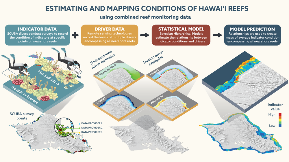
While in situ scuba surveys deliver accurate assessments at specific monitoring sites, physical constraints limit divers to discrete locations, leaving vast stretches of Hawaiʻi’s coastline unmonitored. HIMARC’s predictive mapping framework bridges these spatial gaps.
We use advanced statistical models to define the underlying relationships driving reef condition by pairing our standardized database of localized fish and benthic surveys with continuous environmental and human driver layers. Because these driver datasets span the entire coastline, we project these established relationships into unsurveyed areas. This can then generate seamless, archipelago-wide indicator maps.
To track ecological trends over time, the HIMARC team has completed baseline statewide models for 2004–2014 and is currently developing the 2015–2024 time series, offering an evolving picture of Hawaiʻi’s nearshore ecosystems.
What is an Indicator?
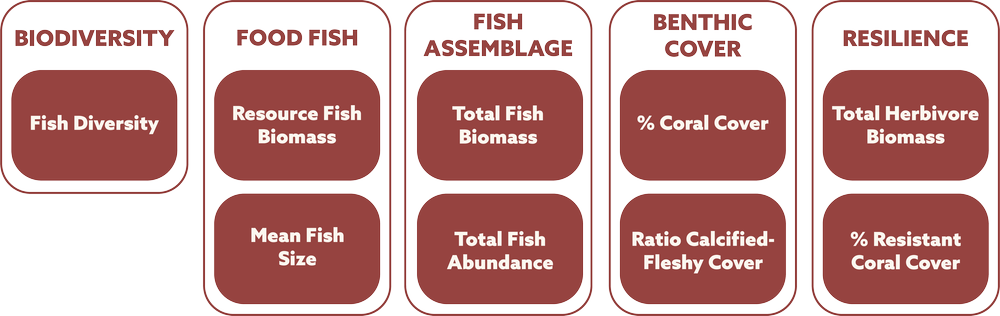
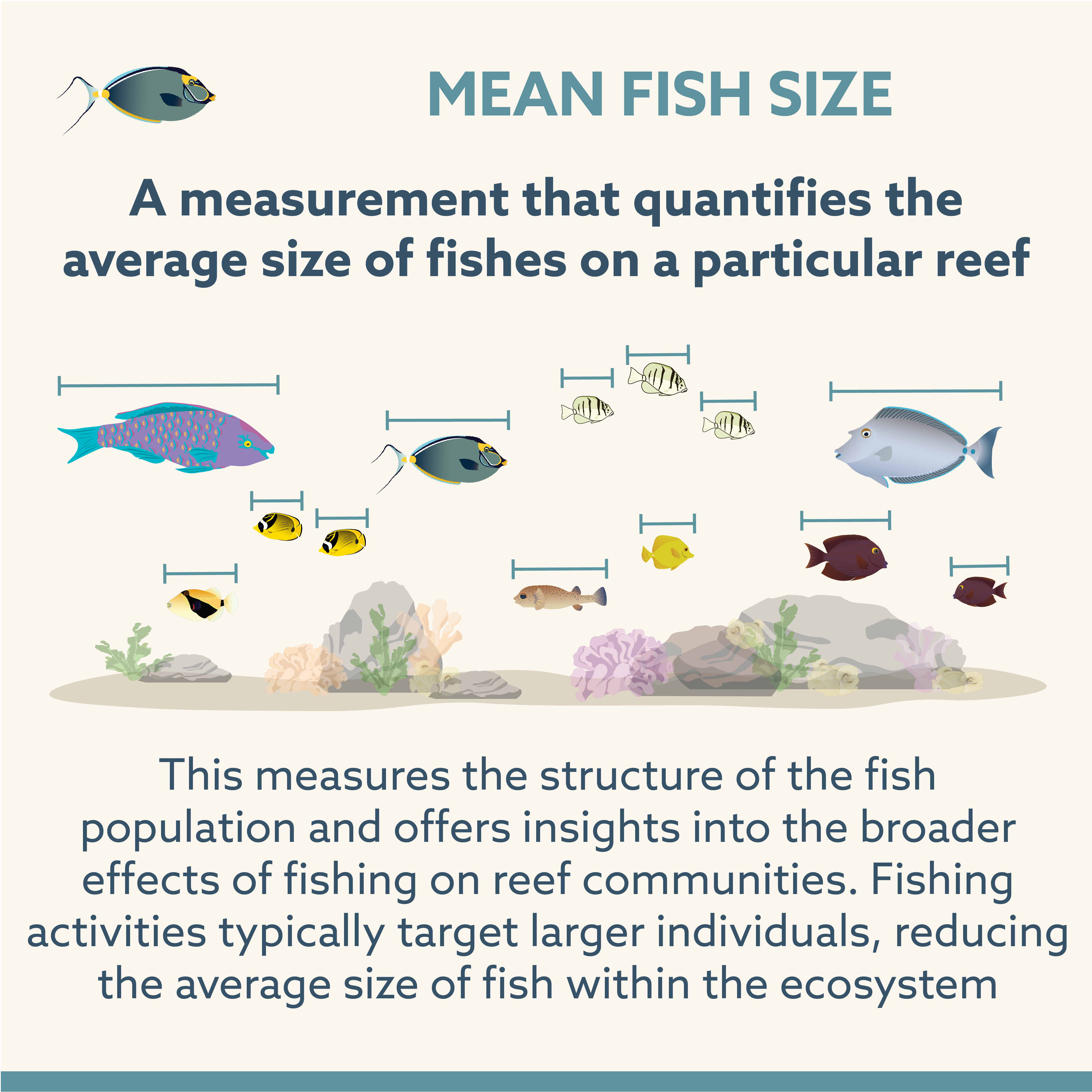
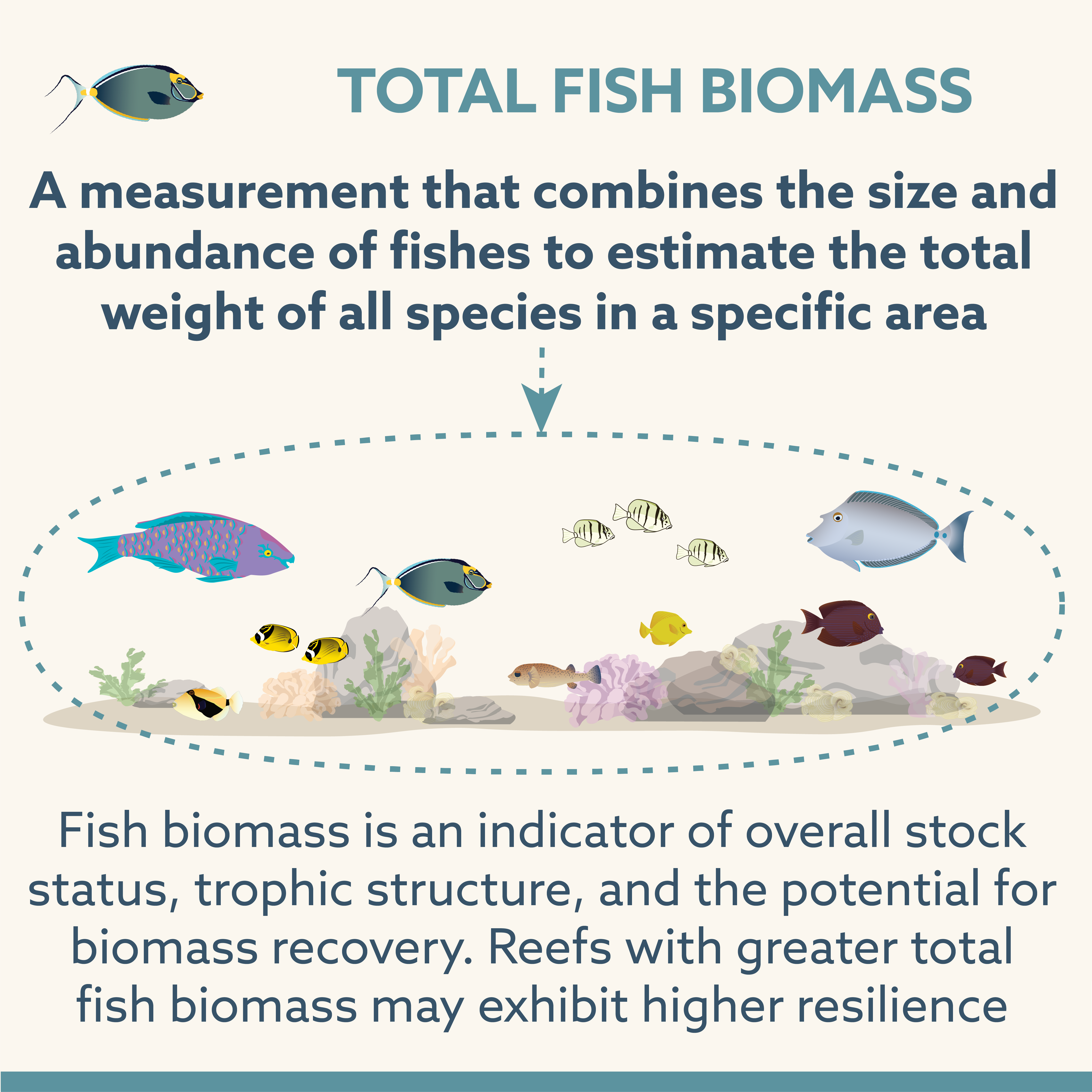
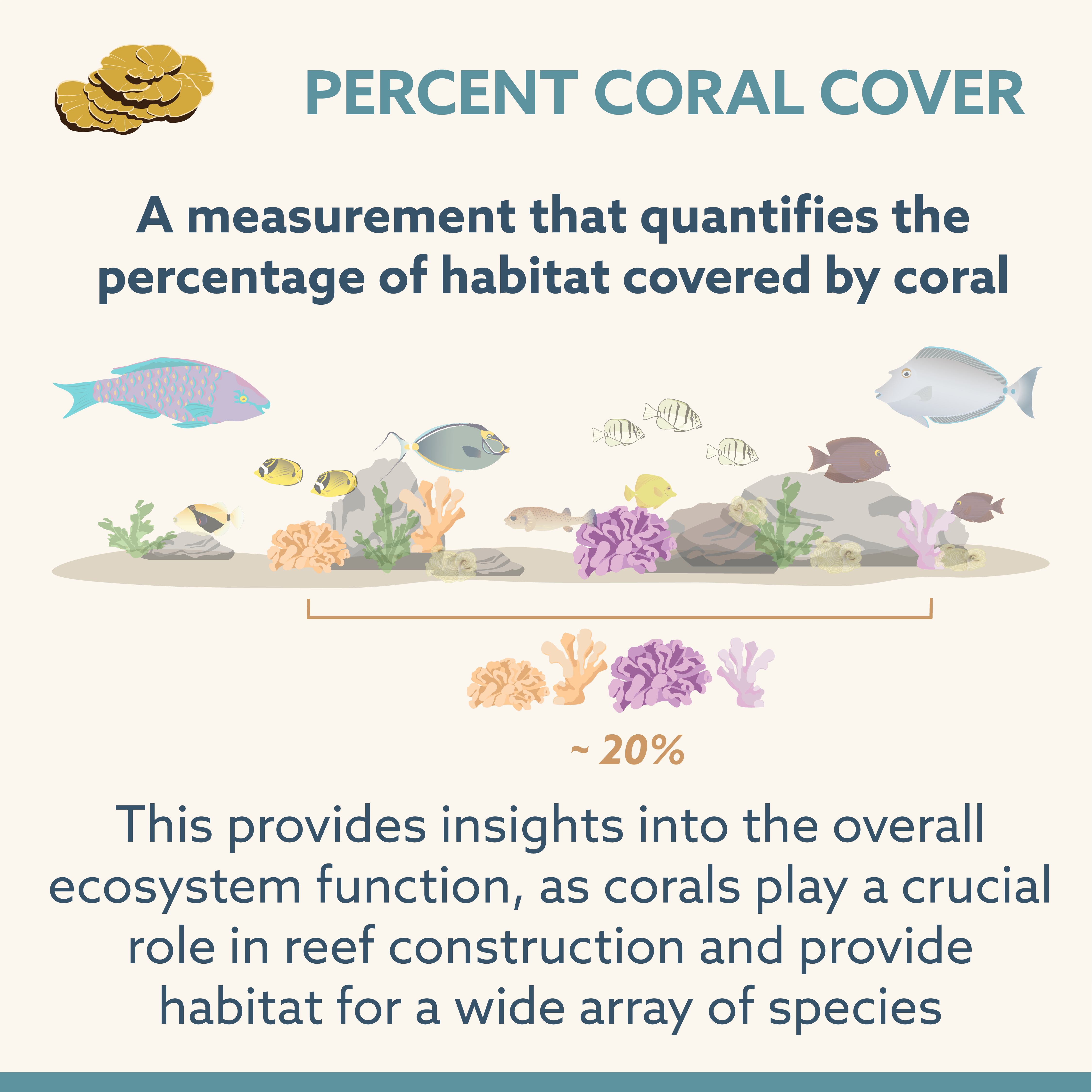
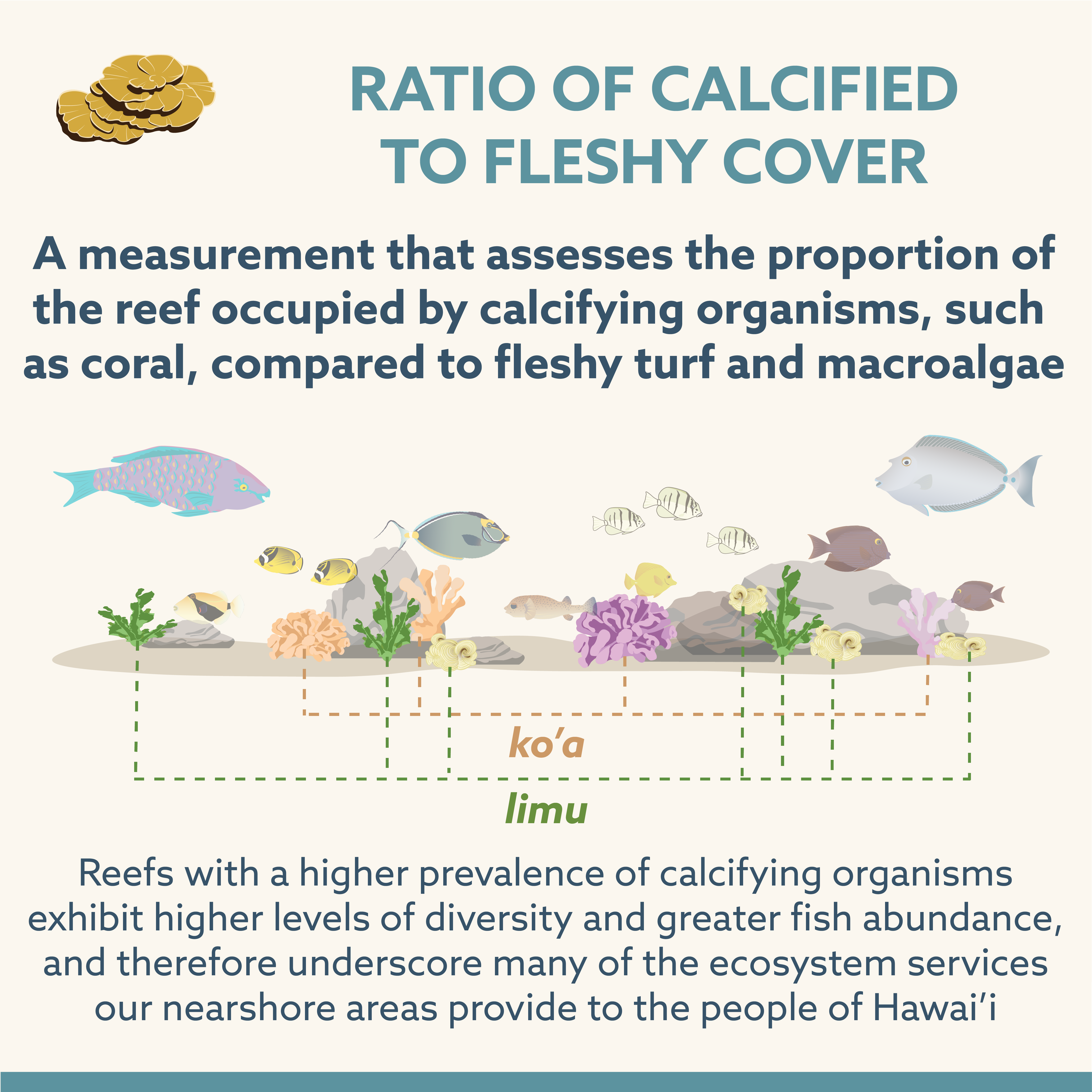
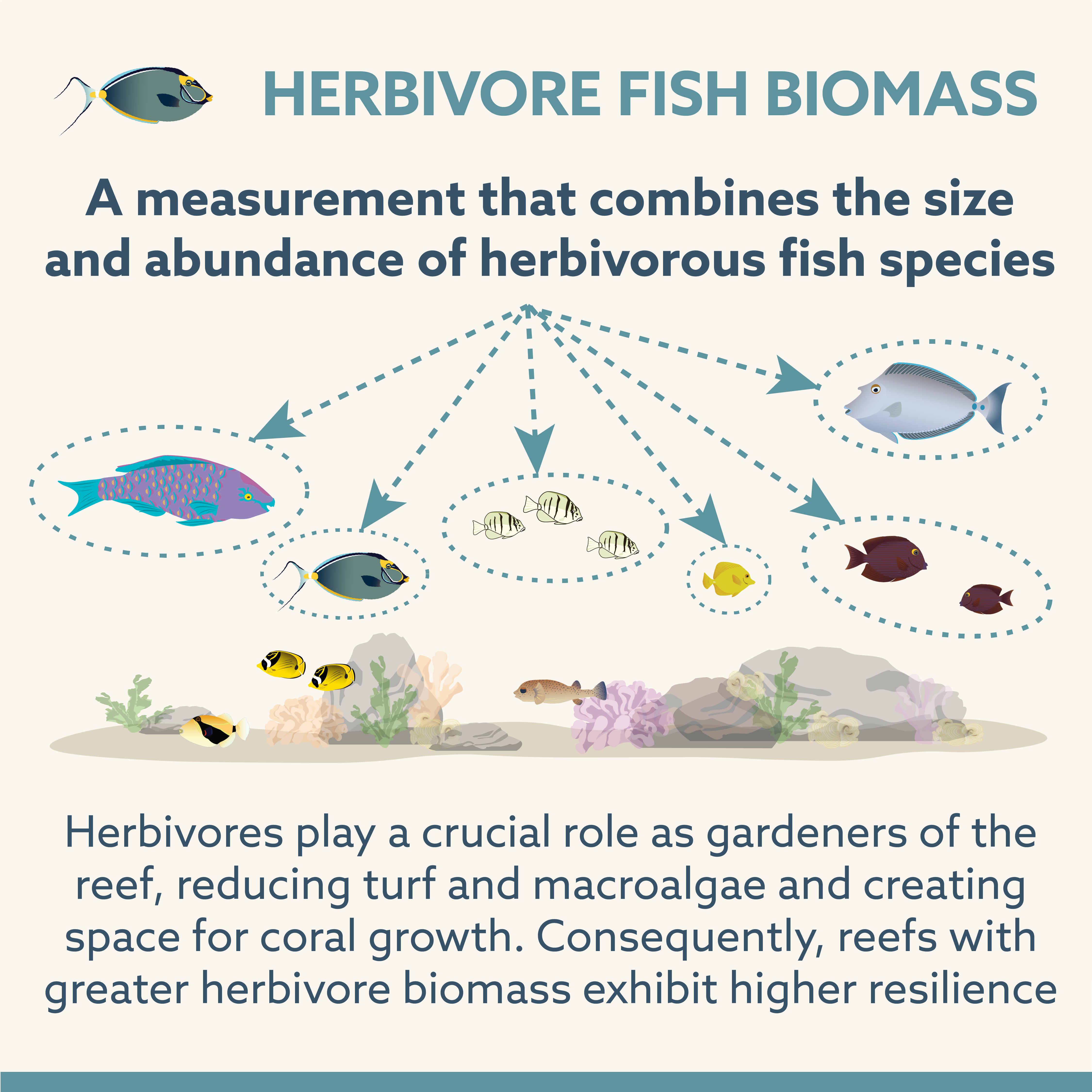
Data from the combined HIMARC database, representing quality-controlled and calibrated surveys, are summarized into key indicators representing specific measurements applicable to management and tell us about coral reef health and resilience.
Indicators were selected after conducting a comprehensive literature review and applying multiple criteria to evaluate their relevance in addressing management questions.
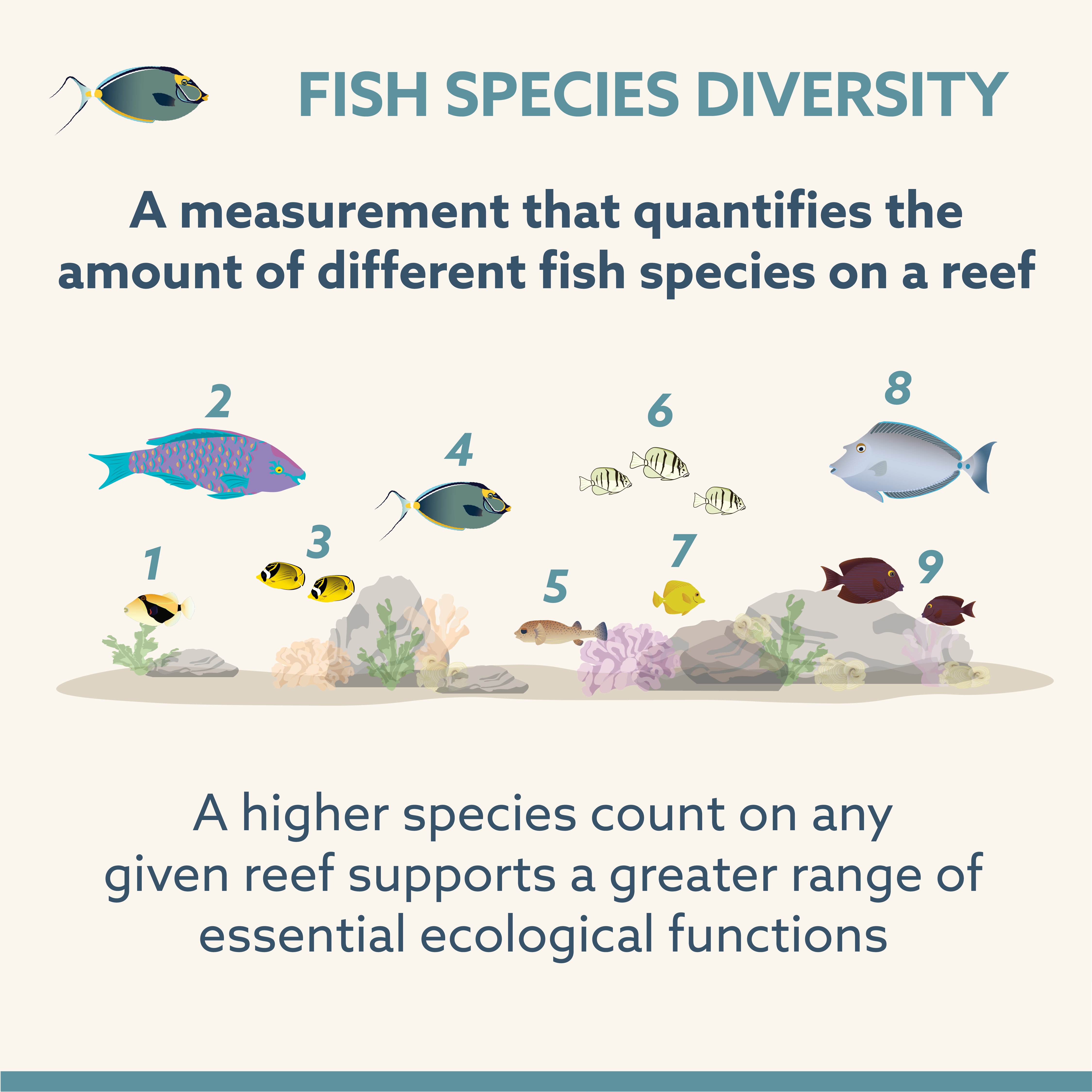
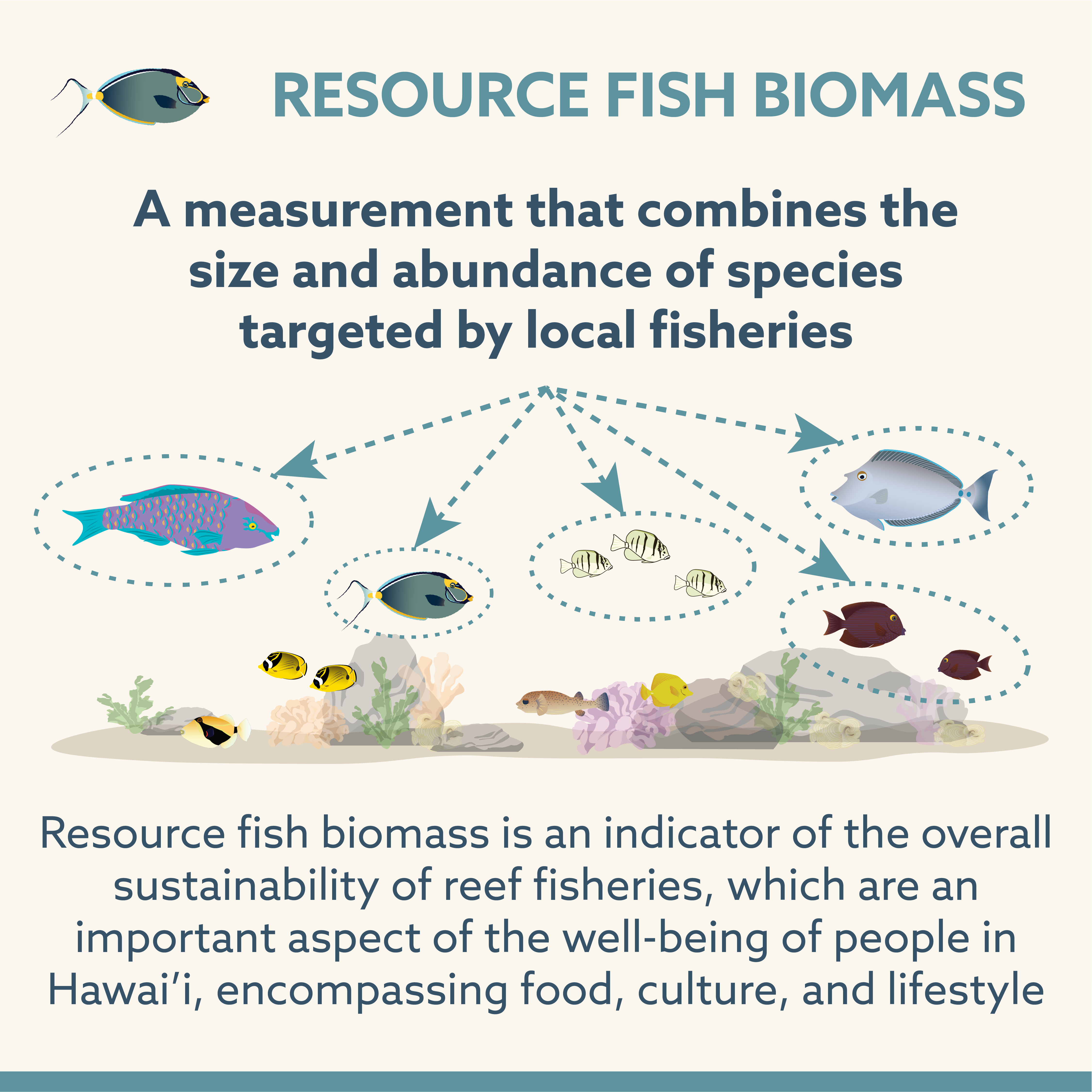
Learn more about some of our indicators
How are Indicators Modeled?
Our predictive framework utilizes a Bayesian hierarchical approach, allowing us to model complex, real-world ecological variation across different islands and regions. These models explain variation in reef indicators as a function of anthropogenic and biophysical drivers. Because spatial drivers often exhibit multicollinearity, we do not feed every variable directly into the model. Instead, HIMARC analysts use a collaborative selection process to identify the most ecologically relevant and statistically appropriate inputs.
HIMARC initiates the modeling process in statistical programs by establishing weakly informative priors, which creates unbiased baselines for our parameters. The model mathematically updates these priors against our statewide database of empirical field observations to generate posterior distributions, quantifying the specific relationships between each indicator and its drivers. This integration culminates in a multidimensional predictive framework that captures how environmental conditions and human stressors interact simultaneously to shape Hawaiʻi’s reef ecosystems.
Generating Statewide Indicator Maps
We generate continuous statewide maps by applying our fitted Bayesian equations to the underlying grid of island-wide driver layers. Nearshore habitats are divided into standard-sized grid cells. For every cell, the model calculates a predicted indicator value using that location’s specific combination of environmental and human drivers at a given timepoint. This calculation occurs across all cells, regardless of whether empirical field surveys exist for that location.
This projection converts discrete survey points into a continuous spatial grid across the Main Hawaiian Islands. The resulting raster layers allow us to evaluate modeled reef condition at any point along the coast, giving managers a consistent, high-resolution dataset to pinpoint high-biomass reefs, identify degraded areas, and prioritize local management interventions.